Unit 5 Overview: Agriculture and Rural Land-Use Patterns and Processes
6 min read•january 13, 2023
P
Pooja Kalyan
Riya Patel
AP Human Geography 🚜
320 resourcesSee Units
Unit 5 ~ composes anywhere from 12-17% of the AP Exam’s content
How do you get your food every day? This unit examines the origins of agriculture and how it has spread throughout history. A primary focus is on the role technology has played in transforming methods of food production over time. The unit also includes a careful examination of the global system of food production and trade and how this system affects countries with varying levels of economic development. Finally, the unit will conclude with an analysis of the positive and negative consequences of modern land use and food production methods.
Key Questions
- Why do certain regions produce certain types of crops?
- Why are cities not optimal places to grow food?
- How have agricultural innovations affected the world?
- What is the Green Revolution, and how does it affect world food production?
- Why is sustainable agriculture such an important topic for the future?
Evolution of Agriculture
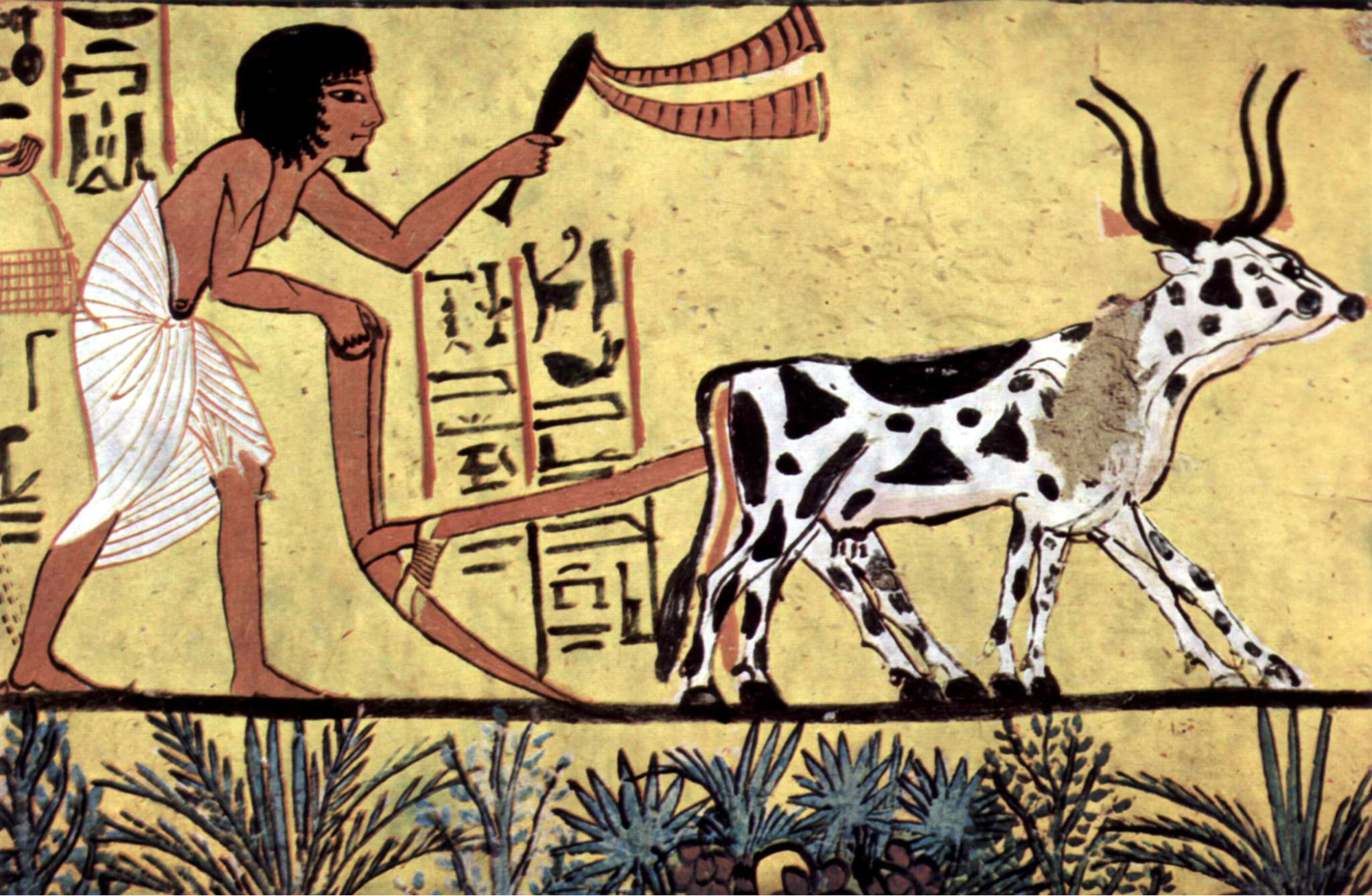
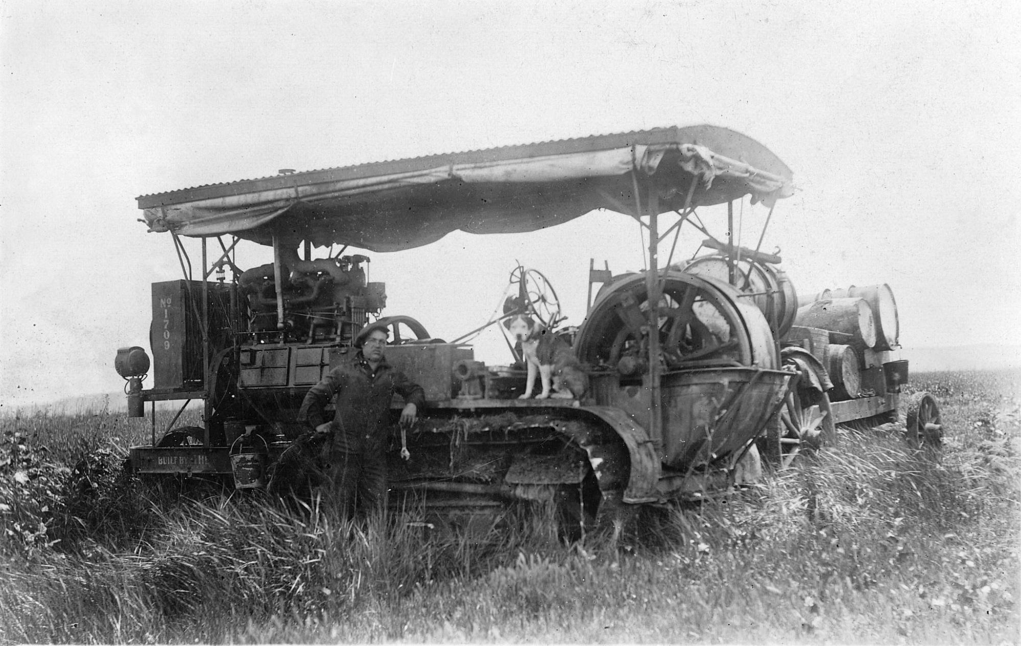
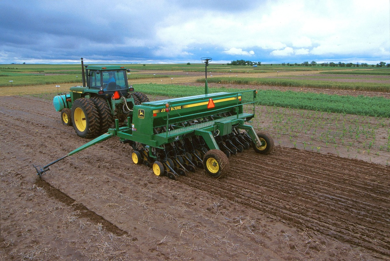
Agricultural production has changed dramatically over time. First, hunter-gatherer societies began domesticating plants and animals during the First Agricultural Revolution. Improved farming techniques and mechanization during the Industrial Revolution were important characteristics of the Second Agricultural Revolution. In the past century, the Third Agricultural Revolution (Green Revolution) has transformed the global agricultural system and increased connections between countries worldwide. The common theme in each of these agricultural revolutions has been an increase in the food supply due to improvements in farming practices and agricultural technologies.
Agricultural Innovations Over Time
- commercial cattle ranching the United States
- nomadic herding in the Middle East
- Fruit and nut farming in California.
- Rice farming in parts of Asia.
- Plantation farming.
🎥 Watch: APHUG - The Green Revolution
Cultural Landscapes in Agriculture
Beginning with the first domestication of plants and animals thousands of years ago, humans have been altering natural landscapes to increase agricultural productivity. Cultural landscapes (“built environment”) have evolved as humans have increasingly leveraged agricultural innovations such as terracing, irrigation, and deforestation to raise plants and animals more efficiently. Factory farming practices have become a more common theme in agricultural landscapes since farming first started utilizing mechanization during the Industrial Revolution of the 1700s.
The “Why of Where” in Agriculture
The “Why of Where” in global agricultural production—understanding why certain plants and animals are grown/raised where they are—requires an understanding of global climate zones and economic forces of supply and demand. Some crops can only be grown in humid tropical environments, while others thrive in more moderate climates.
Pastoral nomadism and ranching are more common in regions with dry climates unsuitable for crop production. Besides climate-related restrictions, what farmers decide to produce depends on demand at the local, national, and global scale. For example, more developed countries have more money to spend on food items that would be considered luxuries in less developed countries (tropical fruits, beef products, etc.)
Extensive & Intensive
Knowing the difference between extensive and intensive land use is another critical component required to fully understand the “why of where” concerning agricultural systems.
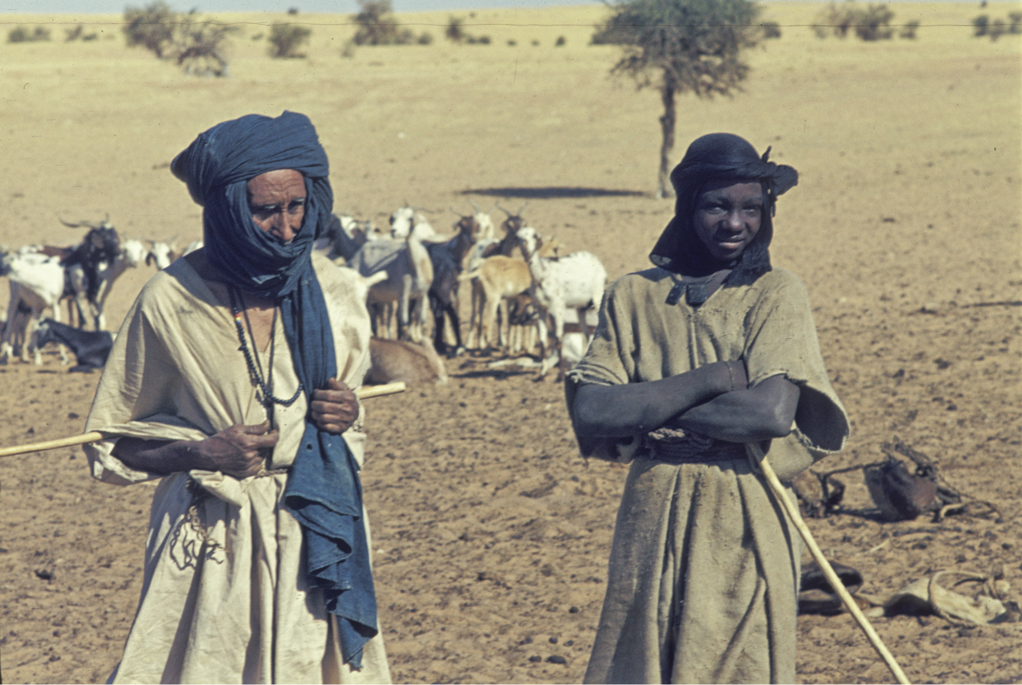
Extensive land use involves a smaller amount of capital resources and paid labor in relation to the amount of space used—common examples include:
Both of these examples utilize large amounts of land with minimal inputs of capital and labor.
Intensive land use requires larger capital and labor inputs relative to the space that is being used. Examples include:
Pastoral Nomads (Extensive)
Market Gardening (Intensive)
Large-Scale Agribusiness
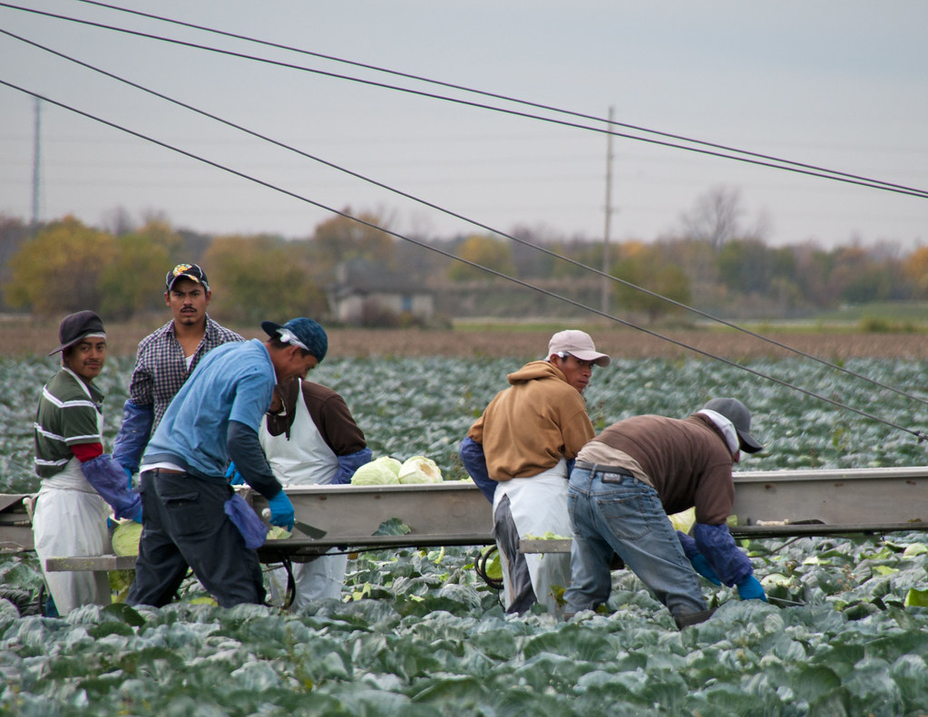
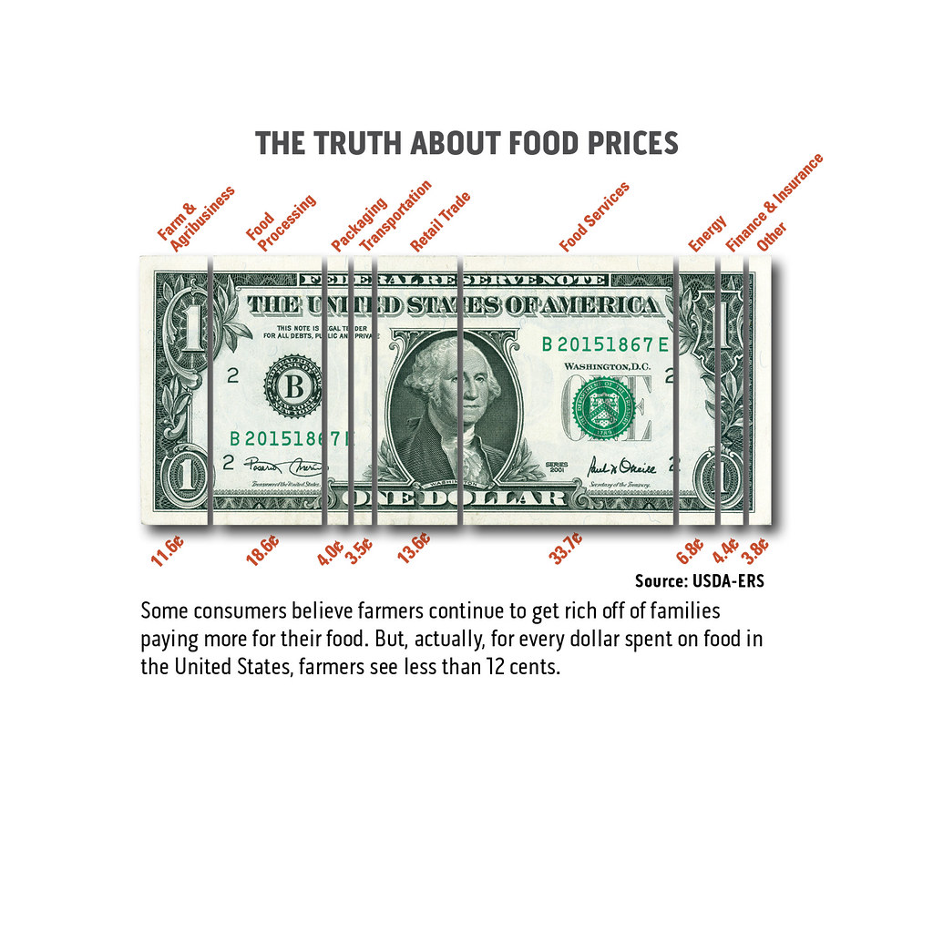
An increasingly common trend in agriculture has been a shift away from small family farms to a more complex agribusiness model of food production. While this trend is seen mainly in higher developed countries, it has affected virtually all countries due to increased globalization 🌍. The large-scale agriculture practiced within this model involves far more than simply planting and harvesting crops and raising livestock.
These goods are usually processed in highly mechanized factories, transported to multiple locations, and eventually marketed and sold in various retail outlets. Another critical component of this system is the continued research and development of new crops, fertilizers, agrichemicals, and other agriculture-related technologies.
🎥 Watch: APHUG - Agricultural Supply Chain
Global System of Agriculture
The global system of agriculture refers to the complex network of economic, political, and social relationships that shape the production, distribution, and consumption of agricultural goods around the world. This system is characterized by a high degree of interconnectedness, with countries and regions around the world relying on each other for the production and trade of food and other agricultural products.
The global system of agriculture is shaped by a number of factors, including technological advances, market forces, government policies, and environmental considerations. It is characterized by a high degree of specialization, with different countries and regions specializing in the production of certain crops or livestock based on their natural resources, climate, and other factors.
The global system of agriculture has significant impacts on people and communities around the world, both positive and negative. It can help to ensure a stable and affordable food supply for people in all parts of the world, but it can also contribute to environmental degradation, exploitation of workers and resources, and other negative consequences.
As economic and political relationships have increased worldwide due to globalization, agriculture has become more interconnected 🔗 than ever before. Advancements in transportation and communication technologies have resulted in the development of a highly complex system of global food production involving countries at all levels of economic growth.
🎥 Watch: APHUG - Global System of Agriculture
Rural Land Use
By far the most essential model of rural land use ever developed is the Von Thunen Model, which was initially designed to better understand the relationship between the location of farms in relation to market forces and transportation and production costs. A comprehensive understanding of rural land use also involves knowing the differences between land survey systems such as the metes and bounds, long-lot, and township and range systems.
Von Thunen Model
The Von Thunen model, also known as the Von Thunen Rural Land Use model, is a theory in economics that explains how land use patterns vary with respect to distance from a city. It was developed by the 19th-century German economist Johann Heinrich von Thünen and is often used to analyze the spatial organization of agriculture and other land uses.
According to the Von Thunen model, the value of land decreases as the distance from the city increases. This is because the cost of transportation increases with distance, making it more expensive to transport goods to and from the city. As a result, the most valuable land is located closest to the city, and it is used for the production of high-value crops that can be sold at a higher price to cover the cost of transportation. Land that is further from the city is used for the production of lower-value crops, or for activities such as forestry or ranching that do not require transportation to the city.
The Von Thunen model provides a useful way to understand the spatial organization of land uses around cities and to predict how changes in transportation costs or other factors may affect land use patterns. However, it is a simplified model and does not take into account all of the complex factors that influence land use decisions in the real world.
Metes and Bounds, Long-lot, and Township and Range Systems
Metes and bounds, long-lot, and township and range systems are all ways of describing and surveying land for the purpose of ownership and boundary demarcation.
The metes and bounds system involves describing the boundaries of a piece of land by specifying the distance and direction of each line that defines the boundary. This can be done using a variety of units of measurement, such as feet or meters, and may include reference to natural landmarks, such as rivers or trees, as well as man-made features like roads or buildings.
The long-lot system is used in areas with long, narrow tracts of land, such as those found along rivers or lakes. In this system, the land is divided into long, narrow lots that run parallel to the water body. Each lot typically has a river or lakefrontage and extends back a certain distance from the water.
The township and range system is used in the United States to divide and survey land in a grid pattern. In this system, the land is divided into square townships that are each about 6 miles (9.7 kilometers) on a side. Each township is further divided into 36 smaller squares called sections, which are each about 1 mile (1.6 kilometers) on a side. The township and range system makes it easy to locate and describe specific parcels of land using a set of coordinates.
Browse Study Guides By Unit
🗺Unit 1 – Thinking Geographically
👪Unit 2 – Population & Migration
🕌Unit 3 – Cultural Geography
🗳Unit 4 – Political Geography
👨🌾Unit 5 – Agriculture & Rural Land-Use
🌇Unit 6 – Cities & Urban Land-Use
💸Unit 7 – Industrial & Economic Development
✏️Frequently Asked Questions
🧐Multiple Choice Questions (MCQ)
✍️Free Response Questions (FRQ)
📆Big Reviews: Finals & Exam Prep

Fiveable
Resources
© 2023 Fiveable Inc. All rights reserved.